

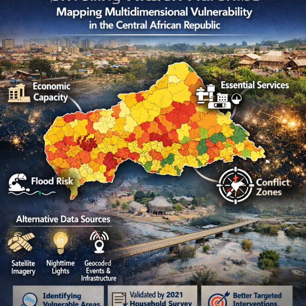
The Central African Republic remains one of the world’s most data-constrained and conflict-affected nations, where insecurity and institutional fragility make traditional surveys slow, expensive, and often impossible. A new analytical paper, “Leveraging Alternative Data to Map Multidimensional Vulnerability in the Central African Republic (English),” introduces a powerful solution: a high-resolution geospatial dashboard designed to reveal hidden patterns of deprivation and risk.
Why Traditional Data Falls Short in Fragile States
In stable environments, policymakers rely on household surveys and administrative records to track poverty and service delivery. In fragile states, however, conflict and weak institutions disrupt fieldwork and degrade data quality. The result is a visibility gap: the areas most in need are often the least measured.
This study confronts that gap by integrating alternative data sources:
-
Nighttime light intensity to approximate local economic activity
-
Satellite imagery to detect settlements and environmental conditions
-
Geocoded infrastructure inventories for schools, clinics, and water access
-
Critical event records capturing floods and lethal conflict
A Dashboard That Sees What Surveys Cannot
At the core of the research is an innovative geospatial dashboard producing indices at a 5×5-kilometer scale, allowing analysts to observe micro-regional disparities that national averages conceal. The system estimates:
-
Economic capacity
-
Access to essential services (education, health, water)
-
Flood exposure
-
Lethal conflict risks
To achieve this, the authors employ a Bayesian state-space model to disaggregate sectoral GDP and combine it with friction-based accessibility metrics, which estimate how terrain and infrastructure affect travel to services.
Stark Spatial Inequalities Emerge
The findings confirm what anecdotal evidence has long suggested but rarely quantified:
-
Economic activity clusters heavily around Bangui, the capital and primary urban hub
-
Rural regions face layered vulnerabilities, with weak economic opportunity and poor access to schools, clinics, and safe water
-
Environmental and security risks overlap, amplifying hardship in already fragile communities
Validation Against Household Data
Despite operating in a data-scarce context, the dashboard’s outputs were cross-validated using the 2021 Harmonized Household Living Conditions Survey. The results are striking:
-
Economic and service-access indicators show strong positive correlations with household welfare and wealth
-
The indices demonstrate predictive validity, suggesting they can reliably guide policy decisions
The Conflict Paradox
One of the study’s most intriguing observations is a paradoxical relationship between lethal conflict exposure and higher-value economic targets. Rather than uniformly depressing economic indicators, some conflict-prone areas align with relatively higher activity levels. The authors caution that this may reflect rent-seeking dynamics, where violence concentrates around valuable assets rather than the poorest zones.
Why This Matters for Policy and Aid
For governments, NGOs, and international institutions operating in fragile states, precision targeting is notoriously difficult. Misallocation wastes scarce resources and leaves vulnerable populations behind. Tools like this dashboard offer:
-
Scalable monitoring without constant field surveys
-
Fine-grained spatial intelligence for interventions
-
Rapid updates as conditions change
In contexts like the Central African Republic, such innovations may redefine how poverty, risk, and resilience are measured.
A Blueprint for Other Conflict-Affected Nations
Beyond a single country, the methodology signals a broader shift in development economics and humanitarian analytics. As satellite coverage, machine learning, and probabilistic modeling advance, alternative data systems could become essential infrastructure for global poverty reduction, particularly where traditional measurement fails.
Report – Here

More Stories
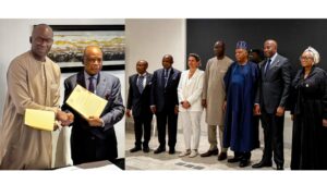
ICC Deputy Prosecutor concludes mission to Nigeria, signing a Memorandum of Understanding to enhance complementarity
The ASP President expresses concern over recent media reports regarding the ongoing disciplinary process involving the ICC Prosecutor
ICC hosts Focal Points Retreat of Asia-Pacific Academic Forum